Innovation has always been the lifeblood of engineering, driving the relentless pursuit of precision, efficiency, and progress. In the field of measurement, where accuracy defines the success of a project, the evolution from traditional tools to modern 3D point cloud scanning has been nothing short of revolutionary. What was once a domain dominated by tape measures, calipers, and theodolites is now enhanced by cutting-edge technologies capable of capturing millions of data points in mere seconds. For engineers who thrive on precision, the advent of 3D point cloud scanning isn’t just a step forward—it is a leap into a new dimension of possibilities.
This essay explores why 3D point cloud scanning is superior to traditional measurement tools and how it has transformed industries reliant on meticulous measurements. From its unparalleled accuracy to its versatility across disciplines, 3D scanning has redefined what engineers can achieve. Moreover, understanding its historical context and transformative applications paints a vivid picture of its indispensability in modern engineering.
The Precision Revolution: Why Accuracy Matters
In engineering, precision is non-negotiable. Whether designing a suspension bridge, reverse-engineering a turbine, or analyzing a historical artifact, even the smallest measurement error can cascade into catastrophic results. Traditional measurement tools, such as rulers, micrometers, and even advanced total stations, have served well for centuries. However, they are inherently limited by human error, labor-intensive processes, and a lack of data richness.
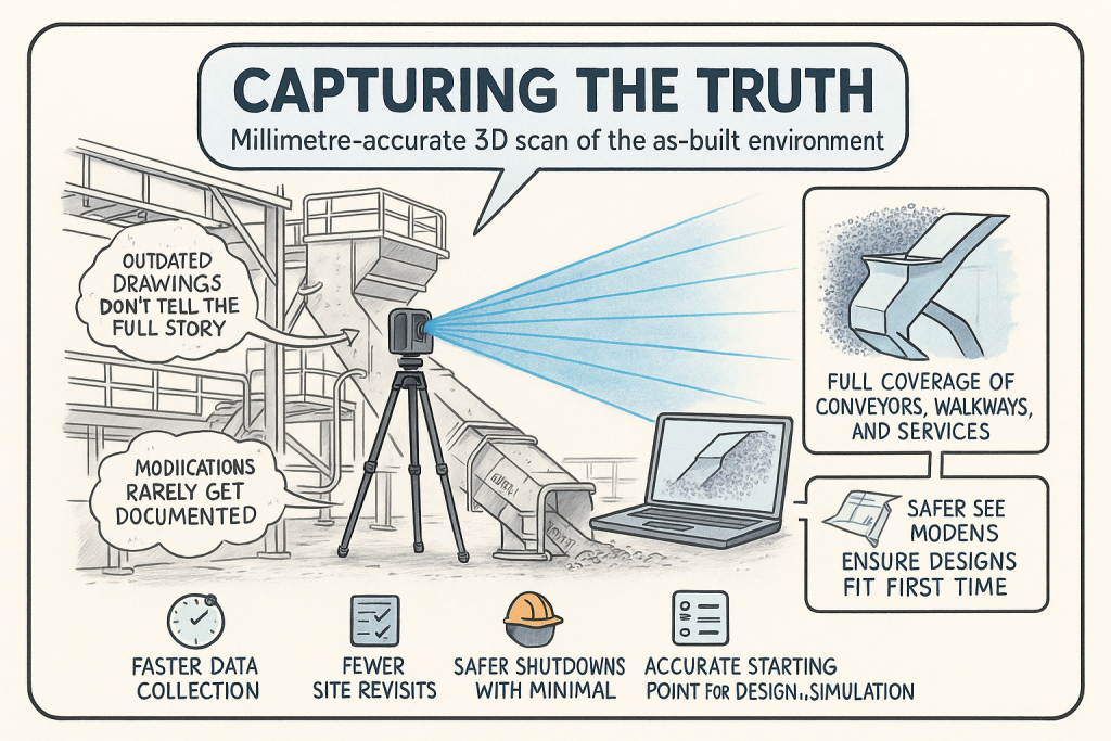
Enter 3D point cloud scanning—a method capable of capturing reality in its entirety, down to sub-millimeter accuracy. Using lasers, structured light, or photogrammetry, these devices create dense clouds of data points that map every surface of an object or environment. This precision is not only reliable but repeatable, providing engineers with the confidence needed to tackle complex challenges. A tape measure might tell you the height of a column, but a 3D scanner reveals its curvature, texture, and deviations, offering insights that traditional tools simply cannot.
Speed Meets Sophistication: Efficiency Redefined
Time is often as critical as accuracy in engineering projects. Traditional methods of measurement require repetitive manual effort—measuring, recording, and verifying. This process, while effective, can be painstakingly slow, especially for large-scale projects such as construction sites, manufacturing plants, or natural landscapes.
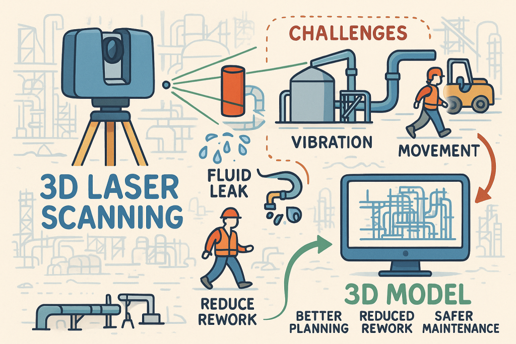
3D point cloud scanning redefines efficiency. Imagine capturing a sprawling construction site, complete with every structural element, terrain feature, and anomaly, within hours. Such speed transforms workflows, allowing engineers to allocate time to analysis and design rather than tedious data collection. For example, laser scanners used in construction can document an entire building with intricate details, enabling real-time adjustments and reducing costly delays.
Moreover, this efficiency does not come at the expense of quality. A scanner’s ability to gather millions of data points in seconds ensures that no detail is overlooked, offering engineers a comprehensive dataset to work with.
Beyond Measurement: The Power of Data Richness
Traditional measurement tools excel at providing dimensions—length, width, and height. While sufficient for many applications, this linear data often falls short when dealing with irregular shapes, complex geometries, or intricate textures. The richness of data captured by 3D scanners, however, goes far beyond basic dimensions.
Point clouds provide a three-dimensional map of an object or space, capturing every nuance of its geometry. This data is invaluable in engineering disciplines such as reverse engineering, where understanding the intricacies of an object’s design is critical. For instance, when reconstructing a turbine blade, knowing its exact dimensions isn’t enough. Engineers need to understand its curvature, surface finish, and wear patterns—all of which are effortlessly captured by 3D scanning.
Furthermore, point clouds are digital assets, easily integrated into software like AutoCAD, Revit, and SolidWorks. This seamless compatibility enables engineers to create detailed models, run simulations, and even conduct structural analyses without revisiting the physical site. It is the bridge between physical and digital realms, offering possibilities limited only by imagination.
Non-Invasive Precision: The Gentle Touch of Technology
Engineers often face challenges where physical contact with a measurement object is either impractical or damaging. Traditional tools struggle in such scenarios, but 3D point cloud scanning thrives.
Take, for example, the preservation of historical monuments. Measuring tools like calipers or rulers could harm fragile artifacts or fail to capture their intricate details. Conversely, 3D scanners use non-contact methods to create accurate digital replicas, preserving the artifact’s integrity while providing a permanent record for future study. Similarly, in hazardous environments, such as inspecting a high-voltage power station or assessing structural damage post-earthquake, scanners allow engineers to collect precise data from a safe distance.
A Look Back: The Evolution of Measurement Tools
To appreciate the impact of 3D scanning, it’s worth understanding the tools it has replaced. The history of measurement dates back to ancient civilizations, where rudimentary tools like plumb bobs and measuring rods were used to construct awe-inspiring structures like the pyramids. Over centuries, tools evolved into more sophisticated instruments, including the theodolite for angular measurements and micrometers for minute details.
While these tools marked significant advancements, they remained limited by their analog nature and reliance on human skill. The 20th century introduced electronic and laser-based tools, bridging the gap between traditional methods and digital innovation. However, even these modern instruments are eclipsed by the capabilities of 3D point cloud scanning, which represents the culmination of centuries of progress in measurement technology.
Applications Across Industries: A Versatile Tool
The versatility of 3D scanning makes it indispensable in various engineering fields. In construction and architecture, it enables Building Information Modeling (BIM), where precise scans of a site are used to create digital twins. This helps architects and engineers visualize and plan projects with unmatched accuracy.
In manufacturing, 3D scanners streamline quality control by detecting defects or deviations from design specifications. They also facilitate reverse engineering, allowing engineers to replicate or improve existing products.
In surveying and mapping, scanners revolutionize topographical surveys by capturing vast terrains in remarkable detail. This data aids urban planning, flood risk analysis, and infrastructure development. Even in healthcare, engineers rely on 3D scans to design prosthetics and surgical implants tailored to individual patients.
Each application underscores the scanner’s ability to adapt to diverse challenges, proving its superiority over traditional tools.
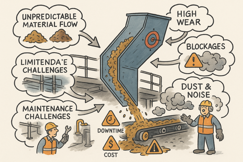
Challenges with Traditional Tools: Lessons from the Past
Traditional tools, despite their utility, often fell short in large-scale projects. Consider the surveying of a mountainous region using theodolites—a task requiring days, if not weeks, of effort, with no guarantee of perfect accuracy. Similarly, in manufacturing, calipers and gauges might miss microscopic defects that compromise product quality. These limitations highlight the need for tools capable of capturing comprehensive and precise data.
Looking Forward: The Future of 3D Scanning
The future of 3D scanning is bright. Advances in technology promise even faster scanning, higher resolutions, and better integration with artificial intelligence and augmented reality. Engineers will soon work with real-time 3D data overlaid on physical objects, enabling on-the-spot analysis and decision-making.
A Paradigm Shift in Measurement
For engineers, measurement is more than a task—it is the foundation of innovation. The transition from traditional tools to 3D point cloud scanning represents a paradigm shift, offering unparalleled accuracy, efficiency, and versatility. Whether documenting the past, designing the present, or envisioning the future, 3D scanning empowers engineers to achieve what was once thought impossible. In embracing this technology, the engineering community not only enhances its craft but also lays the groundwork for a future where precision knows no bounds.
Recent News & Reports on 3D Scanning / LiDAR / Laser Scanning
Revolutionising Industries: 3D Scanners’ New Tricks in 2025
Details how 3D scanners are being applied across sectors with enhanced capabilities.
https://www.objective3d.com.au/docs/revolutionising-industries-3d-scanners-new-tricks-in-2025/ Objective3D
Artec 3D scanning to take center stage at Australian Manufacturing Week
Highlights how 3D scanning is being featured in major manufacturing events in Australia.
https://www.artec3d.com/events/australian-manufacturing-week-2025 artec3d.com
Emerging Trends in 3D Laser Scanning and LiDAR Technologies: The Future
A forward-looking article on trends in 3D laser scanning / LiDAR and their industry impact.
https://iscano.com/laser-scanning-lidar-future-trends/emerging-trends-3d-laser-scanning-lidar-technologies/ Iscano
The future of 3D Scanning: Trends to Watch for in 2025
Predictions on how 3D scanning will evolve in various industries.
https://digitalscan3d.com/the-future-of-3d-scanning-trends-to-watch-for-in-2025/ digitalscan3d.com
3D Scanner LiDAR: How It’s Changing Architecture and Engineering
Discusses how LiDAR scanning is influencing construction, design, visualization, and engineering workflows.
https://www.foxtechrobotics.com/a-news-3d-scanner-lidar-how-it-s-changing-architecture-and-engineering.html foxtechrobotics.com
How Blue Laser Technology is Transforming 3D Scanning
Reports on the technical advancement of blue-laser scanning and its improved data capture performance.
https://industry-australia.com/technical-articles/99722-how-blue-laser-technology-is-transforming-3d-scanning Industry Australia
How AI & 3D Scanning Will Shape Manufacturing in 2025
Explores integration of scanning + AI in manufacturing sectors.
https://manufacturingdigital.com/articles/ai-3d-scanning-impacting-manufacturing-verticals Manufacturing Digital
3D Scanners Global Report 2025: Market to Reach $8.8B by 2030
Market analysis showing projected growth in 3D scanning globally.
https://www.globenewswire.com/news-release/2025/04/02/3054347/0/en/3D-Scanners-Global-Report-2025-Market-to-Reach-8-8-Billion-by-2030-as-Wider-Adoption-of-3D-Scanners-Still-Faces-Certain-Roadblocks.html GlobeNewswire
Intelligent Execution: Leveraging 3D Scanning Technology for Enhanced Project Delivery
Article on how mobile scanning + LiDAR is improving project delivery in engineering / construction.
https://energynow.com/2025/01/intelligent-execution-leveraging-3d-scanning-technology-for-enhanced-project-delivery-in-engineering-and-construction/ EnergyNow
“Revealed: Chopper laser stopping Aussie disaster”
Example of aerial LiDAR scanning used in Australia for disaster assessment / terrain mapping.
https://www.couriermail.com.au/real-estate/national/laser-giving-superhero-vision-following-natural-disasters/news-story/890ed3ab1b57f780f37ea113005a735b The Courier-Mail
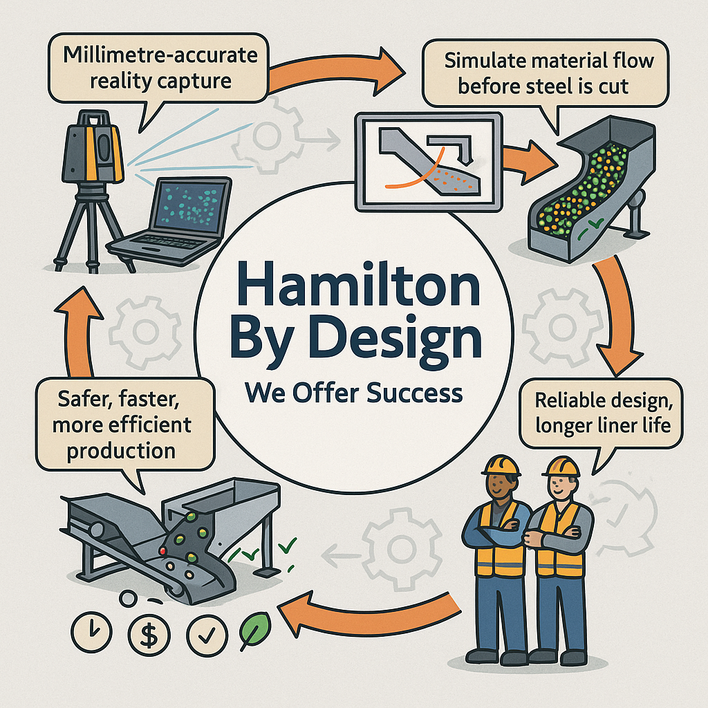
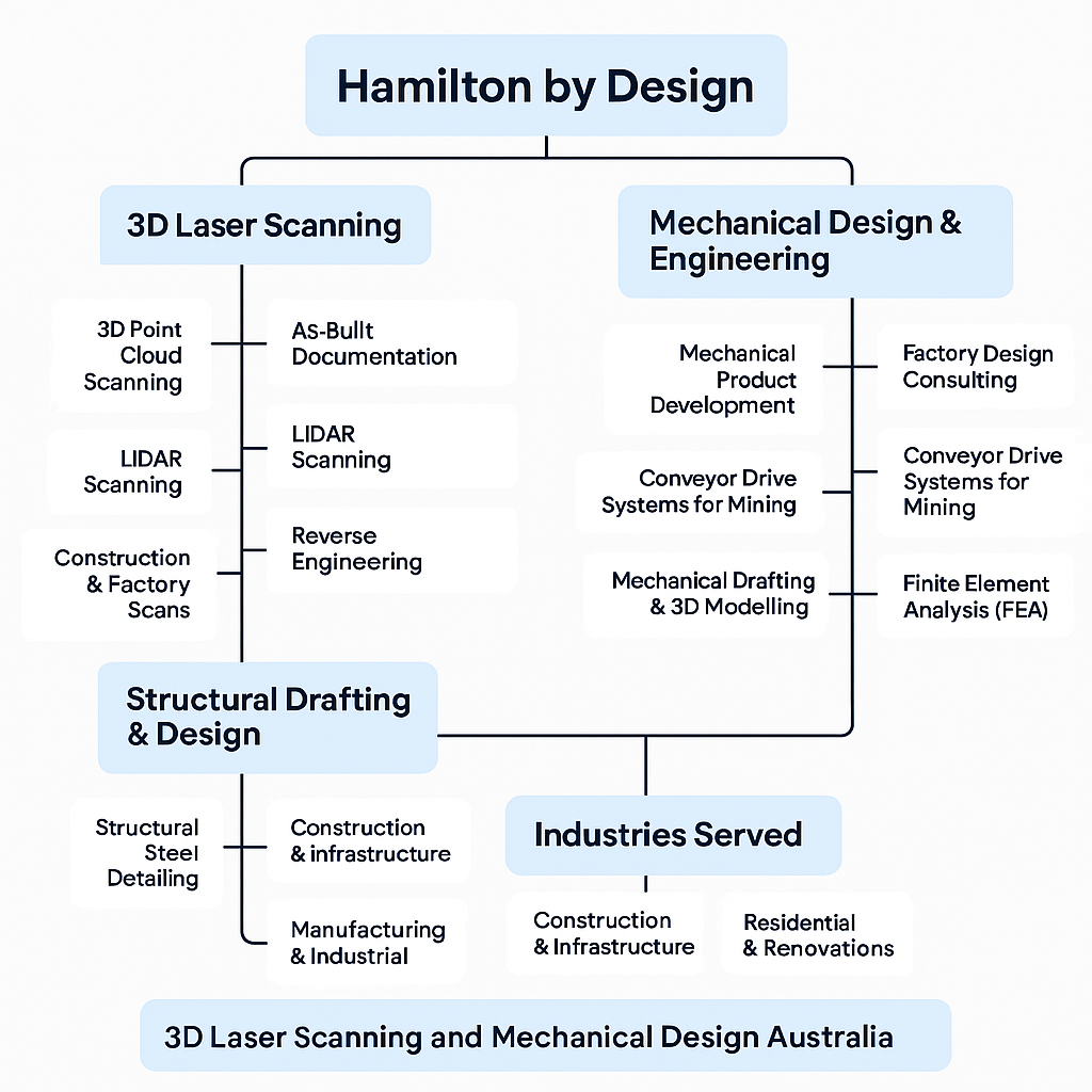
Hamilton By Design | 3D Scanning